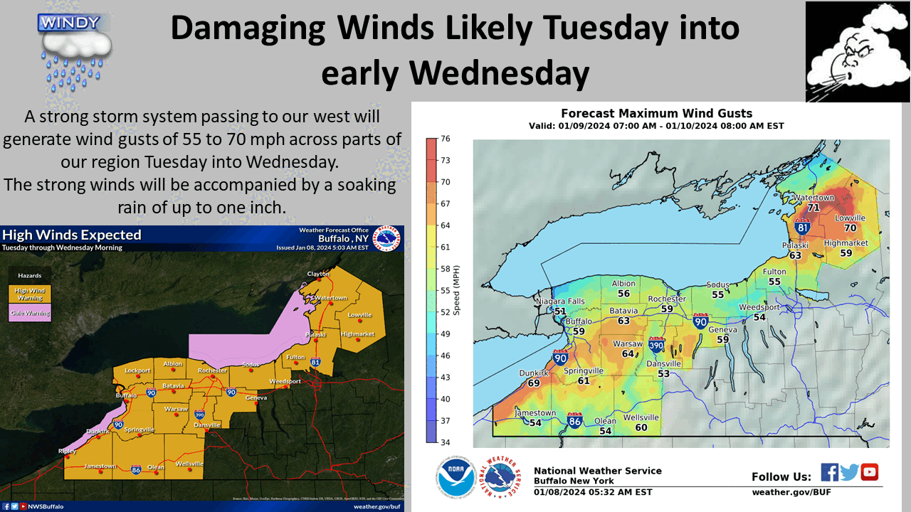
Heavy rain. Wind. And even some snow. Then comes another system. In summary, it’s going to be a very busy weather week across the Finger Lakes. Calm weather Monday will be replaced by a damaging wind threat on Tuesday.
What’s Coming?
For much of the Finger Lakes and Central New York the action begins on Tuesday, when the National Weather Service says a brief period of snow or wintry mix is expected during the morning and early afternoon hours.
The precipitation will then transition to heavy rain by evening, but along with that will be strong, potentially damaging winds. Sustained winds between 35-45 mph are forecasted, along with gusts that could exceed 65 mph.
Impact and Warnings
At this point, the National Weather Service has already issued a High Wind Warning for a big chunk of the region – including Ontario, Livingston, Wayne, and Monroe counties. Northern Cayuga County is also included in this warning. These areas are expected to see the strongest wind gusts out of this system. The Warning runs from Tuesday through Wednesday morning.

Much of the remainder of the region – including Southern Cayuga, Seneca, Onondaga, and Yates counties are in a High Wind Watch. This could be turned into a High Wind Warning or Wind Advisory before the end of the day.
A Wind Advisory has already been issued for Tompkins, Schuyler, Steuben, and Chemung counties. These areas will see slightly lesser wind gusts over the same period of time. Due to the heavy rain, there’s an increased threat across the board that trees fall.
So, if you’re traveling in the rural parts of the Finger Lakes or Central New York use caution.
Looking Ahead
There’s going to be…
Read the full article here
Leave a Reply