

STATEN ISLAND, N.Y. — It seems New Yorkers will not have to wait long to see more measurable snowfall, as a weekend storm is set to bring a couple of inches to the New York City region.
More than an inch of snow fell across parts of Staten Island late Monday night into early Tuesday morning, making a mess for the morning commute and bringing a definitive end to the extensive snow drought that loomed over New York City for more than 700 days.
Now, as the previous storm’s snowfall lingers on city streets, a second system draws near, bringing with it amounts of precipitation resembling Tuesday’s system.
THE CHILL BEFORE THE SNOW
Residents awoke to a frigid freeze Wednesday morning with a low of 15 degrees Fahrenheit, according to the Advance/SILive.com weather station. The sunshine remained ineffective in combatting the biting cold; Wednesday’s high reached only 24 degrees around 3 p.m., as recorded by the Advance/SILive.com weather station.
AccuWeather Senior Meteorologist Dave Dombek noted that Thursday holds much of the same, a dry yet cold day. There is the potential for a couple of flurries in the afternoon, but Dombek dismissed them as “no big deal.”
NYC SNOW FORECAST
However, Dombek forecasts that very late Thursday night, potentially early Friday morning, will see the onset of light snow. This precipitation will persist into Friday morning and linger about the New York City area into a portion of Friday night.
“Could be something similar, give or take, compared to what we just dealt with recently as far as snow is concerned,” Dombek said.
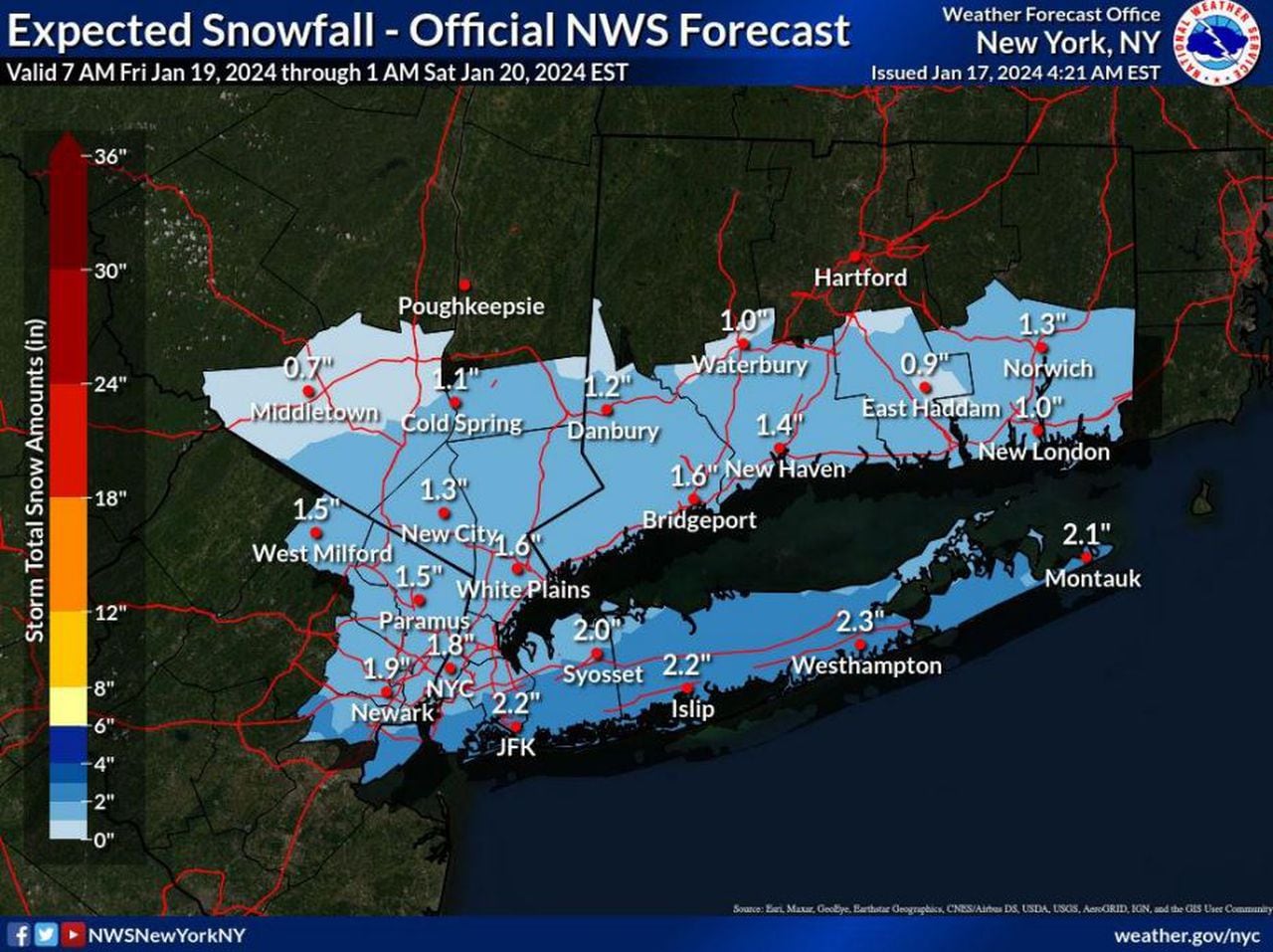
The light snow is expected to remain consistent and the storm will likely drop anywhere between 1 and 3 inches across New York City.
A National Weather Service graphic shows anticipated snowfall amounts in New York for Friday, Jan. 19 through Saturday, Jan. 20, 2024. (Courtesy of the National Weather Service)(Courtesy of AccuWeather)
The National Weather Service (NWS), meanwhile, forecasts that Staten Island and much…
Read the full article here


