

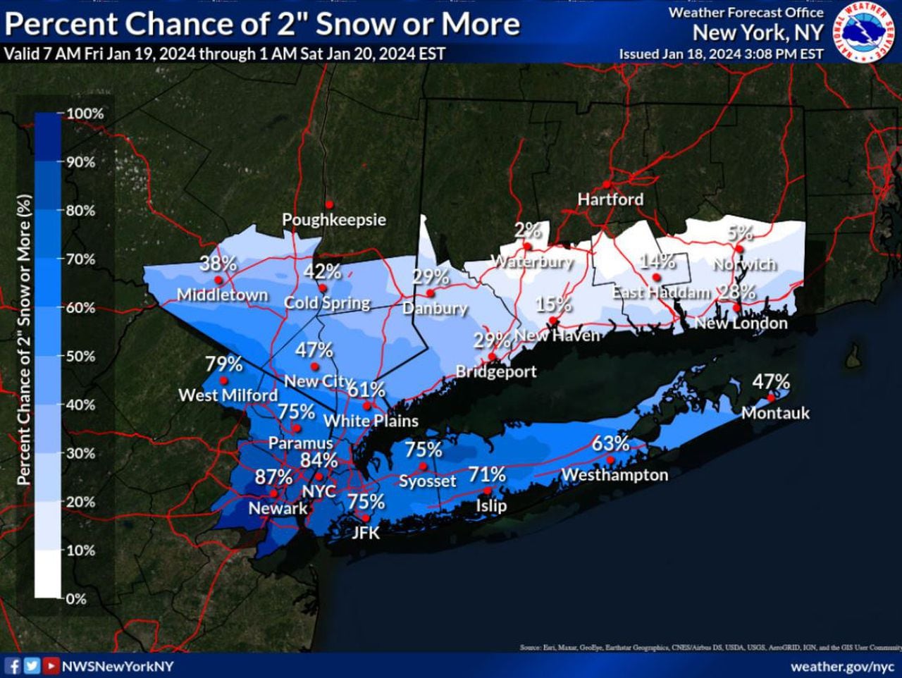
STATEN ISLAND, N.Y. — New York City is bracing for the second bout of measurable snowfall this week. While parts of upstate New York will be spared precipitation, Staten Islanders could see upwards of three inches of snow.
Friday’s anticipated combination of freezing temps and consistent snow has prompted state officials to take action in preparation for the conditions to come. The New York City Emergency Management Department has issued a travel advisory and is working in tandem with city agencies, including the New York City Department of Sanitation, to monitor the encroaching system, poised to make a mess of both the morning and evening commutes.
“With more snow expected throughout the day tomorrow, our city agencies are prepared, and we encourage all New Yorkers to plan for a messier commute and take the necessary precautions to remain safe,” New York City Mayor Eric Adams said. “We’ll continue to keep New Yorkers updated about what to expect and, as always, the best way to stay safe is to stay informed — sign up for Notify NYC to get the latest information directly from the city.”
THE LATEST ON WHAT WEATHER TO EXPECT
The National Weather Service (NWS) issued a Winter Weather Advisory Thursday afternoon, warning of the poor conditions predicted for New York City and the surrounding area.
As day breaks Friday and residents begin are roused for the morning commute, the first snow flakes will begin floating down to city roadways. The NWS foresees Staten Island witnessing the initial onset sometime around 7 a.m., with snow sweeping across the remainder of the city by 10 a.m. Friday morning.
The light snow, which is expected to be a drier, powder-like precipitation, as opposed to a heavy, wet snowfall, will remain consistent throughout the afternoon hours.
“Probably never really snowing really hard,” said AccuWeather Senior Meteorologist Dave Dombek. “There might be a few times where the snow does come down and it’s a little bit more noticeable,…
Read the full article here


