

STATEN ISLAND, N.Y. — While snow has fallen on New York City streets since 8 a.m. Friday, the accumulation thus far looks to fall short of the originally estimated 3 inches of snow for Staten Island. Despite reaching the ground, the flakes don’t seem to stick around long enough to make for any substantial accumulation. Regardless, the storm will still plague the evening commute before making way for a blast of cold air to move in for the weekend.
“It looks like Staten Island, an inch to an inch and a half pretty much, we’re thinking; most of that is on non-cement surfaces too,” National Weather Service (NWS) Meteorologist Jay Engle said.
Even if the snowfall pales in comparison to a torrential snow storm of times past, the precipitation is poised to muddle the evening commute.
THE EVENING AHEAD
Snow continues to line wires and trees, casting the city in a coat of white. However, the conditions make for some slippery streets that are sure to trouble commuters looking to make it home and ring in the weekend.
The NWS issued a “special weather statement” Friday afternoon forecasting that, while light snow would taper off in the evening, it will likely linger through the commute. The NWS urged caution for any motorists navigating the roadways.
“By the time we get to 7 p.m-8 p.m. it should pretty much be over, maybe a couple stray flurries for the early evening, but it’s going to be moving out,” Engle said.
Some chilling air will creep in behind this system and pair up with blustering winds to predominantly characterize the weekend. The weather will threaten to produce icy conditions across roadways citywide, as noted by the NWS’ Special Weather Statement.
A COLD WEEKEND
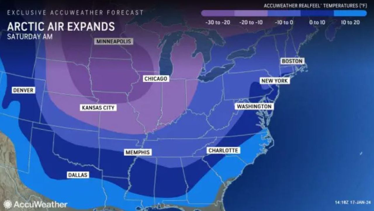
This winter air will feel near zero at times; it’s not the kind of air you want to walk out unprepared for.
An AccuWeather graphic shows arctic air expanding into New York early on Saturday, Jan. 20, 2024. (Courtesy of AccuWeather)(Courtesy of AccuWeather)
Engle reports that Friday…
Read the full article here


