

STATEN ISLAND, N.Y. — While snow melts away from New York City streets following last week’s pair of storms, this week looks to bring extensive periods of rain to the five boroughs.
Following a weekend of frigid temperatures, Tuesday’s temperatures climbed to a high of 40 degrees at around 2 p.m., according to the Staten Island Advance/SILive.com weather station. While the day remained dry, the evening looks to bring a wintry mix of precipitation to areas north and west of New York City, and potentially some spotty showers to the five boroughs, as reported by National Weather Service (NWS) Meteorologist Jay Engle.
“The main concern north and west of the city tonight is for pockets of freezing rain, some black ice, but even up there they’re probably going to get at most an inch well north of the city,” Engle said. “It’s just kind of like a nuisance, could make for some slick travel.”
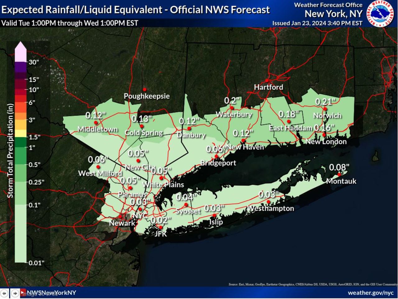
These spotty bouts of rain will persist through Wednesday, and it isn’t until Wednesday night that we’ll see the onset of steady, widespread rainfall, Engle said.
This light rain will continue overnight Wednesday into Thursday before tapering off Thursday night. Even with this extensive period of rain, rainfall totals will likely not exceed an inch, according to the NWS.
Beginning Wednesday, temperatures will remain well into the 40s before shooting up to 58 degrees Friday, the NWS reports. The coming days will be a stark contrast to the low of 17 degrees recorded on Saturday, Jan. 20, by the Staten Island Advance/SILive.com weather station.
While Friday looks to stay dry, another chance of precipitation may come in sometime Saturday night into Sunday.
“On that one right now, it looks to be mostly rain, but it could mix in with a little snow for the weekend,” Engle said.
Read the full article here


