I can’t presume to answer that question on behalf of other scientists, but in my own case I may have been overly reliant on the “climate haven” theme of our region in escaping some of the worst of the broad impacts in the warming climate.
I had written in the past on the known link between a warming climate and more intense and widespread wildfires.
One of the probable oversimplifications in that article was in its dominant focus on mainly western North American wildfires. Wildfires have long been more common in the West, exacerbated by the lengthy megadrought that has now been at least temporarily broken in many western regions. But I didn’t make the connection between more frequent upper air blocking patterns probably linked to more rapid warming in the northern latitudes. These are likely to more often spark such dangerous episodes as what occurred last week in the East.
What does a blocking pattern look like? Last week’s example was a classic. The upper air pattern featured a deep stationary low pressure system near Maine virtually locked in position by a high pressure ridge to the west and another ridge over the Atlantic. The orientation of this block forced a persistent northerly flow to drop through the Great Lakes and the eastern U.S.
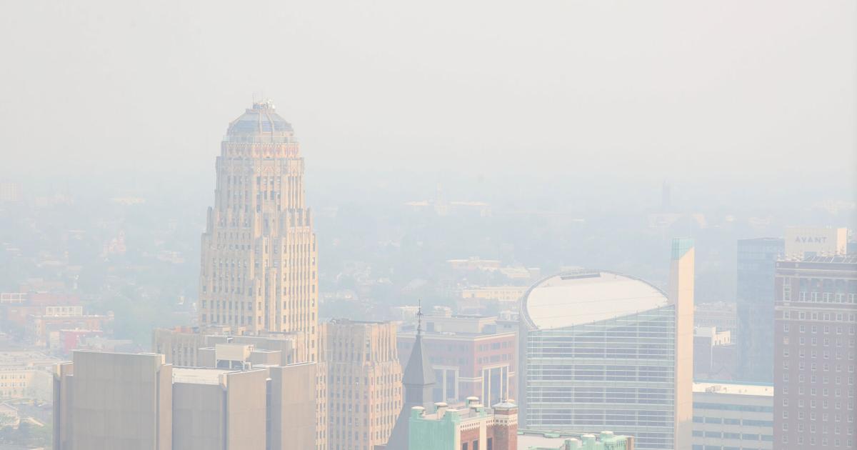
The impacts of the block resulted in the record smoke pollutant so evident in the NASA satellite image.
More than 150 fires were burning in Quebec during this episode and many remained active this weekend, though it is hoped that widespread showers will lessen their intensity early this week.
On Monday morning, some needed rainfall is beginning to reach into portions of Quebec, where fires have been continuing. pic.twitter.com/z6vrlXAIeb
— Don Paul (@donpaulbitsosun) June 12, 2023
Such outbreaks in eastern Canada typically occur with a more westerly flow to evacuate the smoke toward the Atlantic, often leaving our region and much of the eastern U.S. largely untouched by smoke…
Read the full article here
Leave a Reply