Severe thunderstorms ripped across the Finger Lakes and strengthened more in Central New York on Monday afternoon.
There were several tornado-warned storms, and plenty more that had severe thunderstorm warnings associated with them.
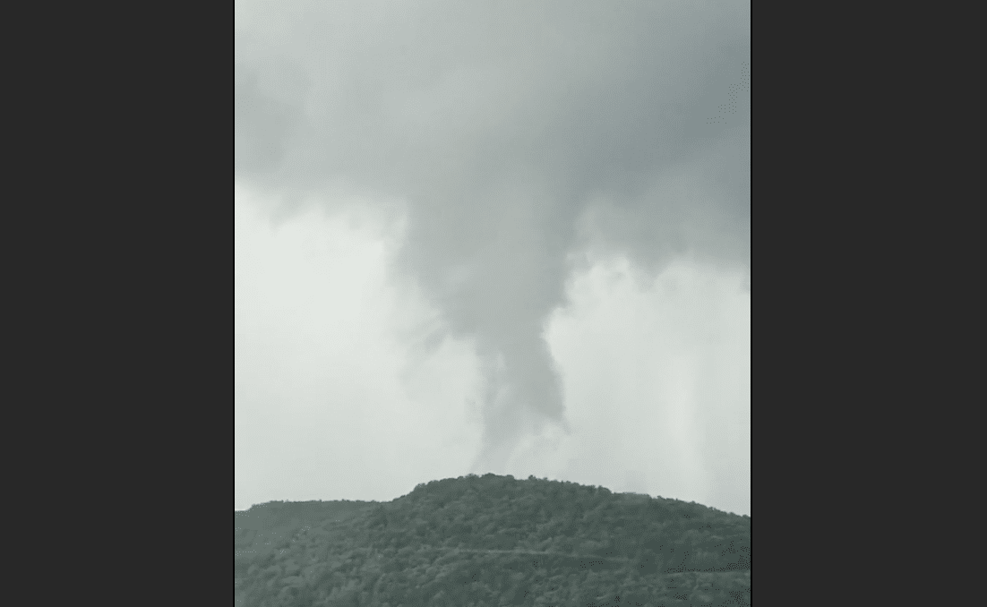
Among the most notable photos and video that were shared to social media, was what’s been described as a small, unconfirmed tornado around 5 p.m. south of Dryden.
Check out video shared to Twitter by Mandy Qualls:
The severe weather threat has passed for the Finger Lakes region, but parts of the region will be cleaning up after damaging winds were reported within some storms.
AFTERNOON UPDATE: Thunderstorms expected to fire up within hours across Finger Lakes
Abundant sunshine late this morning and during the early-afternoon hours is setting up for what forecasters discussed this morning.
The National Weather Service has issued a Tornado Watch for parts of Ohio and Pennsylvania. This is significant given that this area of activity is moving northeast toward Western and Central New York.
The timeframe to watch for looks to be between 4 p.m. and 7 p.m. Thunderstorms will develop in the Southern Tier and push northeast through the afternoon.
While no severe thunderstorm watch has been issued yet, it’s entirely possible for one to be issued within the next two hours.
MORNING UPDATE: Severe weather risk elevated this afternoon across Finger Lakes, Central New York
The risk for severe weather will be on the rise today across the Finger Lakes and Central New York.

According to the National Weather Service, the greatest risk will be in the eastern portion of the region. However, storms will brew as late-morning clearing gives way to an atmosphere ripe for thunderstorm development.
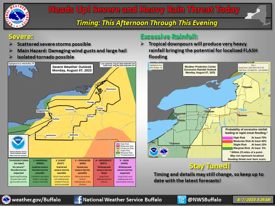
Does it mean you should cancel your outdoor plans for Monday? Absolutely not. However, forecasters are watching the afternoon window – between 12 p.m. and 8 p.m. as the time for development.
If a Severe…
Read the full article here
Leave a Reply