

STATEN ISLAND, N.Y. — Last week’s one-two combo of snow delivered considerably small amounts of accumulation to the New York City area. With another system on the horizon, will we finally see some substantial snowfall?
A TIMELINE FOR THE WEEK
Following the weekend’s icy conditions and cold temperatures, Monday will see some sunshine and temperatures nearing 40 degrees, according to the National Weather Service (NWS). This offers an opportunity for some of that remaining snow and ice to melt.
While Tuesday — and the remainder of the week — looks to hold a high somewhere in the 40s, there is a chance to see the onset of precipitation overnight Tuesday. It remains unclear whether that weather will manifest in the form of snow or rain, according to the NWS.
From there, periods of rain remain sporadic through the end of the week.
“It really could kind of come in multiple waves, really the chance doesn’t decrease until after Friday,” AccuWeather meteorologist Brandon Buckingham said.
This system also does not bear the same intensity of some previous systems, which have dumped multiple inches of rain across New York City. Buckingham said that over the course of three days, some areas could see cumulative amounts up to an inch.
“It does look like you have pulses of moisture working their way in. At the moment, [it’s] not looking like a deluge, heavy downpour-type rain,” Buckingham said.
Despite the absence of torrential rainfall, Buckingham warned that with the ground frozen, any rain could result in potential flooding.
As the rain clears out, Saturday seems to hold mostly cloudy, yet dry, skies with an early AccuWeather forecast calling for a high in the upper 40s.
ABOVE AVERAGE PRECIPITATION
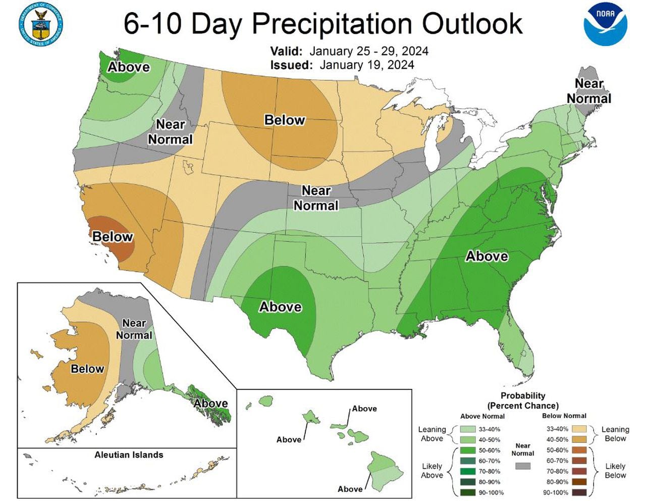
A 6-10-day precipitation outlook issued by the NWS’ Climate Prediction Center does paint a picture of what the end of the coming week will look like.
A 6-10 day precipitation outlook for Jan. 25 through Jan. 29, 2024 as reported by the National Weather Service’s…
Read the full article here


