You might want to keep the winter coats handy and know exactly where your car’s ice scraper is.
The East Coast is gearing up for a cold weather pattern that’s in place to kick off the week as a broad cold snap arrives in the eastern half of the country, according to the National Weather Service.
While Monday night is expected to be mostly clear in NYC, with a low around 30 degrees, wind chill values will be between 25 and 30 degrees.
Tuesday is set to possibly look a little different with a chance of flurries. While the high is expected to hover around near 38 degrees, the day is expected to be mostly sunny. However, winds will possibly be whipping around at 16 – 23 mph making it possible that unsecured objects and holiday decorations can be blown around.
AccuWeather is reminding residents to make sure the furnace is in good working order, as much of the eastern third of the United States will be hit with air from northern Canada that is on the move.
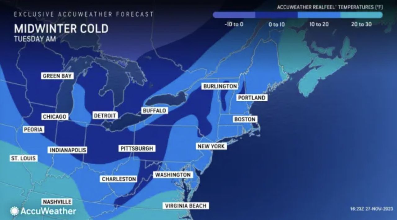
The first major blast of cold air will continue to settle into the East into Wednesday and will not only be responsible for some of the lowest temperatures so far, but also some of the first freezes of the season for areas that have been holding out, AccuWeather meteorologists say.
While the air coming in will not be record-breaking, it will have some shock as the first cold waves of the season often do. Temperatures will run 10-20 degrees below the historical average for late November, making it feel more like late December or January in terms of nighttime lows, AccuWeather is reporting.
Accuweather meteorologists predict that temperatures in the NYC area will dip into the 20s for the first time this season by Wednesday morning, and may even drop into the teens at times for those commuting to work, school or holiday season shopping.
Winds are forecast to ease up by Wednesday evening, but the air will remain chilly with temperatures near the freezing mark for the tree lighting ceremony at Rockefeller Center.
Read the full article here
Leave a Reply