

STATEN ISLAND, N.Y. — New York City looks to get a wintry mix of rain and snow going into next week, but much of upstate New York can prepare for some accumulating snowfall.
Aside from Thursday, the days leading into Sunday look to be dry and mild, with temperatures comfortably set in the 40s.
“First half of the weekend, weather gets a little quieter, tries to dry out some, not sure how much it actually clears; clouds may hang in pretty tough,” AccuWeather Senior Meteorologist Dave Dombek said.
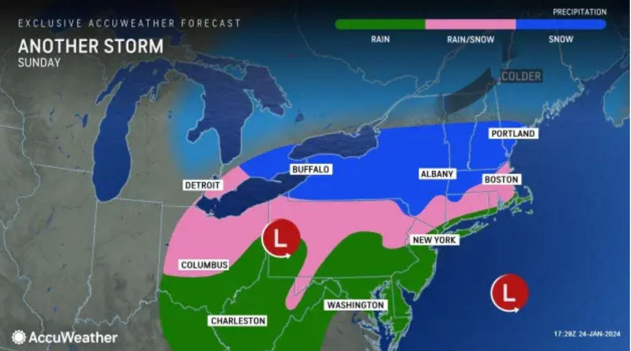
However, as we shift into Sunday, a storm system, which will have passed through the Ohio Valley and southern Appalachians Saturday, will sweep into the Northeast, bringing a swath of varying weather conditions to the Empire State.
NEW YORK STATE: SNOW IS COMING
The current forecast contrast between New York City and New York state will predominantly be over precipitation. Whereas New York City will see more rain, upstate will tend toward snow.
The heaviest snowfall will concentrate over the Catskill Mountains; Dombek foresees accumulation amounts of 3 to 6 inches.
“It’s definitely a more significant situation up there,” Dombek said. “The precip. will go over to snow a lot earlier up there, and it will snow longer, and it actually will have a chance to accumulate.”
Dombek believes that the rain expected for the city will really change over a wintry mix, if not snow, once you get northward of the Tappan Zee Bridge.
Orange County, Sullivan County, and area in the mountains were all mentioned by Dombek as places to particularly see some snowfall.
A National Oceanic and Atmospheric Administration graphic shows the probability of areas exceeding 0.25 inches of liquid equivalent snow/sleet from Sunday, Jan. 28, through Monday, Jan. 29, 2024. (Courtesy of the National Oceanic and Atmospheric Administration)(Courtesy of the National Oceani
AccuWeather notes that the threat of snow and/or an icy mix is a “surefire bet” for areas inland, including the interior Northeast.
Read the full article here


