STATEN ISLAND, N.Y. — With Tuesday’s light rain in the rearview mirror, and Wednesday’s soaker taking to Staten Island shores, what should New York City residents expect over the course of this latest system?
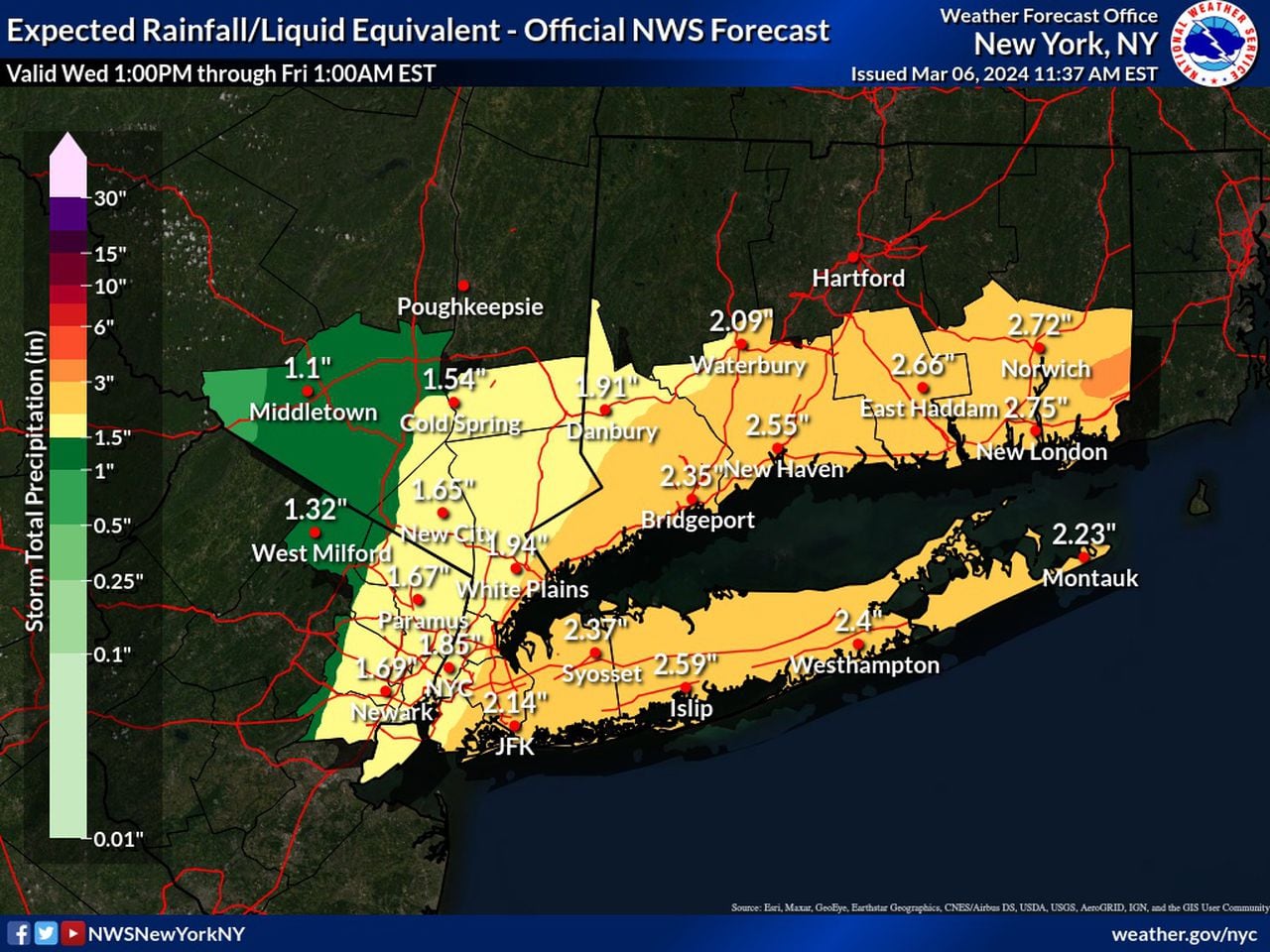
Tuesday’s rainfall brought only 0.13 inches to Staten Island, according to the Advance/SILive.com weather station. However, Wednesday’s system looks to pour anywhere between 1.5 and 2 inches of rain across the five boroughs, as reported by the National Weather Service (NWS).
In anticipation of the excessive rainfall, the National Weather Service has issued a flood watch for the entirety of New York City, while the New York City Emergency Management department issued a travel advisory for heavy rain and flooding from Wednesday into Thursday.
A TIMELINE FOR WEDNESDAY’S SYSTEM
Rain is already creeping up through Staten Island and will persist throughout the remainder of the day.
While an umbrella always does some good, rainfall rates could peak at an inch per hour at times, the NWS notes.
“Rain this afternoon will start to pick up a little more in intensity as you get toward the evening rush, so very late afternoon, early evening tonight,” NWS Meteorologist John Criscantello said.
A National Weather Service graphic shows expected rainfall/liquid equivalent for Wednesday, March 6, 2024. (Courtesy of the National Weather Service)(Courtesy of the National Weathe
These conditions do pose the risk of widespread minor flooding and a chance at some significant flash flooding, the NWS reports.
“There is a chance of just some minor nuisance flooding, that kind of thing,” Criscantello said.
This heavy rain will eventually taper off in the late night hours into Thursday. Criscantello notes that Thursday could hold some lingering light rain with chances at precipitation dropping off as the day progresses.
Thanks to temperatures holding strong in the upper 40s, low 50s, there is virtually no chance of seeing snowfall in this system.
According to the NWS, wind…
Read the full article here
Leave a Reply