STATEN ISLAND, N.Y. — As warmer temperatures close out a spring-like week, the flip to winter begins almost immediately with a chance of snow set to kick off the week ahead.
While areas to the north and west of New York City may receive multiple inches of snow, it seems the Big Apple is most likely in for another round of a wintry mix.
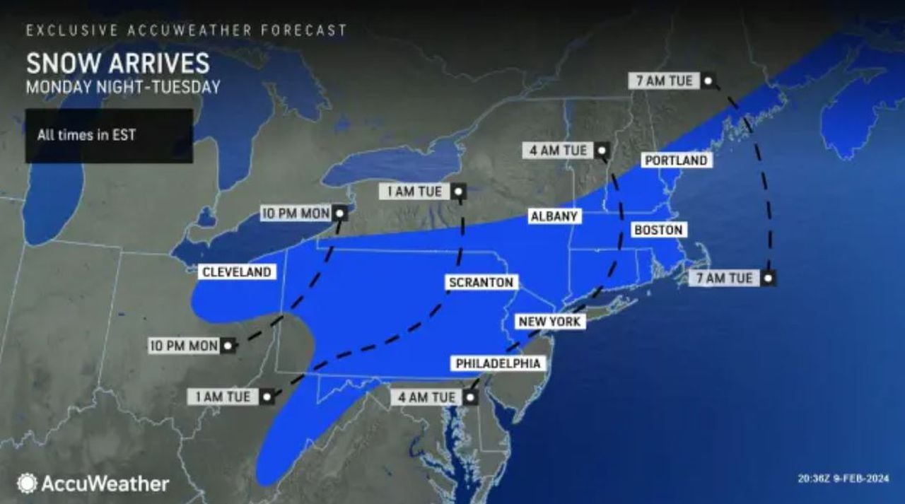
THE TIMELINE
The first portion of the precipitation will likely fall as a slushy blend of rain and snow across much of the Ohio Valley, mid-Atlantic, central Appalachians, and southern New England, thanks to the lingering warm air which characterized much of the previous week, according to AccuWeather.
This especially looks to be the case in the five boroughs of New York City, where temperatures are expected to peak in the upper 50s Saturday, nearing an all-time Central Park high for the day, as noted by AccuWeather Senior Meteorologist Dave Dombek. The current record sits at 61 degrees, set just last year in 2023.
“It looks like precipitation probably gets in here Monday night and continues at least into the day on Tuesday,” AccuWeather Senior Meteorologist Tom Kines said.
An AccuWeather graphic shows a timeline for the winter storm conditions expected in New York on Monday, Feb. 12, 2024. (Courtesy of AccuWeather)(Courtesy of AccuWeather)
Although this precipitation could change with time, early forecasts indicate that New York City will predominantly see rain (at least at the start). Kines reports that the storm could very well depart from the area Tuesday afternoon in the form of snow, but the “in-between” is the real “question mark” at this time.
“At least in the city, we’re thinking certainly more rain than snow,” Kines said. “There’s still a possibility that the storm gets its act together at the last minute, pulls in some colder air, and we get accumulating snow. That certainly hasn’t been ruled out yet.”
HOW MUCH SNOW
As Kines points out, it looks like we will not be buried in an avalanche of snowfall.
Read the full article here
Leave a Reply