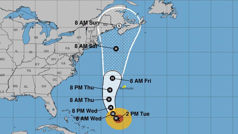
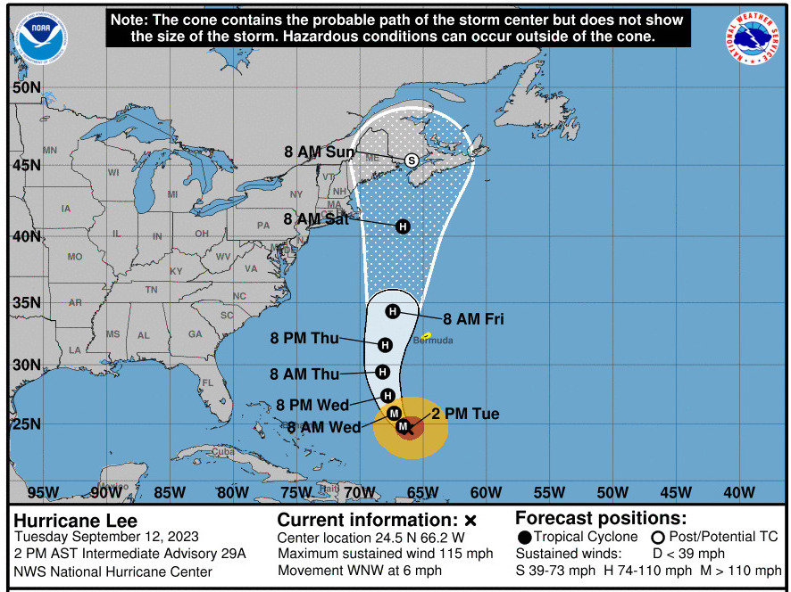
Hurricane Lee is currently moving at a very slow forward pace, but the storm is expected to turn northward and gradually accelerate later this week.
National Hurricane Center
Hurricane Lee will bring perilous rip currents and surf conditions at beaches along the U.S. East Coast this week. And while the strong storm has yet to make landfall anywhere, forecasters are warning people to look out for wind and rain hazards.
Lee is currently a Category 3 hurricane, according to the National Hurricane Center. It’s also much larger than it was just a few days ago: Lee’s hurricane-force winds extend up to 90 miles from its center, with tropical storm-force winds extending for some 205 miles. Compare that to last Friday, when its hurricane-force winds extended 35 miles out.
Here are key things to know about Hurricane Lee, as it starts to move north along the U.S. coast:
The precise path remains uncertain
As of early Tuesday afternoon, Lee was packing 115 mph winds and moving west-northwest at a virtual crawl of just 6 mph. It’s expected to turn more northward by the middle of this week — and the timing of that move will influence it affecting the U.S. Northeast and Atlantic Canada.
The current forecast track shows Lee’s center moving toward New Brunswick, Canada — but along the way, its winds could reach shores from New York to Maine.
“It remains too soon to know what level of additional impacts Lee might have along the northeastern U.S. coast and Atlantic Canada late this week and this weekend,” the NHC said on Tuesday.


A satellite…
Read the full article here
Leave a Reply