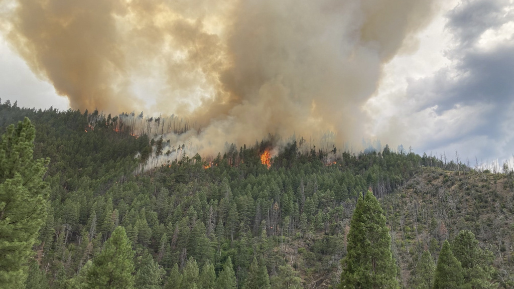

Smoke rises from the Head Fire in Klamath National Forest, Calif., on Tuesday Aug. 15, 2023.
Roger Matthews/AP
A record heat wave in the Pacific Northwest has prompted fire managers to bump the national preparedness level up a notch, from three to four on a five point scale. More than two dozen large fires are now burning in the region, many sparked by dry thunderstorms.
At the National Interagency Fire Center in Boise, federal fire managers monitor giant screens in a NASA like control room, as they deploy air tankers, hot shot crews and other resources around the West right now.
Meagan Conry, the federal Bureau of Land Management’s assistant deputy director for fire and aviation, tracks fires on live cameras in the Northwest. She says the area has become vulnerable to increased fire activity because of, “above average temperatures, dry conditions, and some expectations for gusty winds over the next few days.”
The Northwest and far northern California have been baking in triple digit heat all week, with extremely low humidity. Dreaded dry thunderstorms have brought a lot of wind and new ignitions from lightning strikes, but very little rain.
For context, though, only about 1.6 million acres have burned so far this year, only about a third of the ten year average according to NIFC.
Fire managers say with climate change, things feel pretty flipped upside down right now. It’s the middle of August and yet the worst wildfires so far this year have happened in the tropics and near the Arctic.
“While Canada and Hawaii have had an abnormal and tragic fire season, the United States mainland and Alaska have enjoyed a little bit of peace and quiet,” Conry said.
That could all change after a week like…
Read the full article here
Leave a Reply