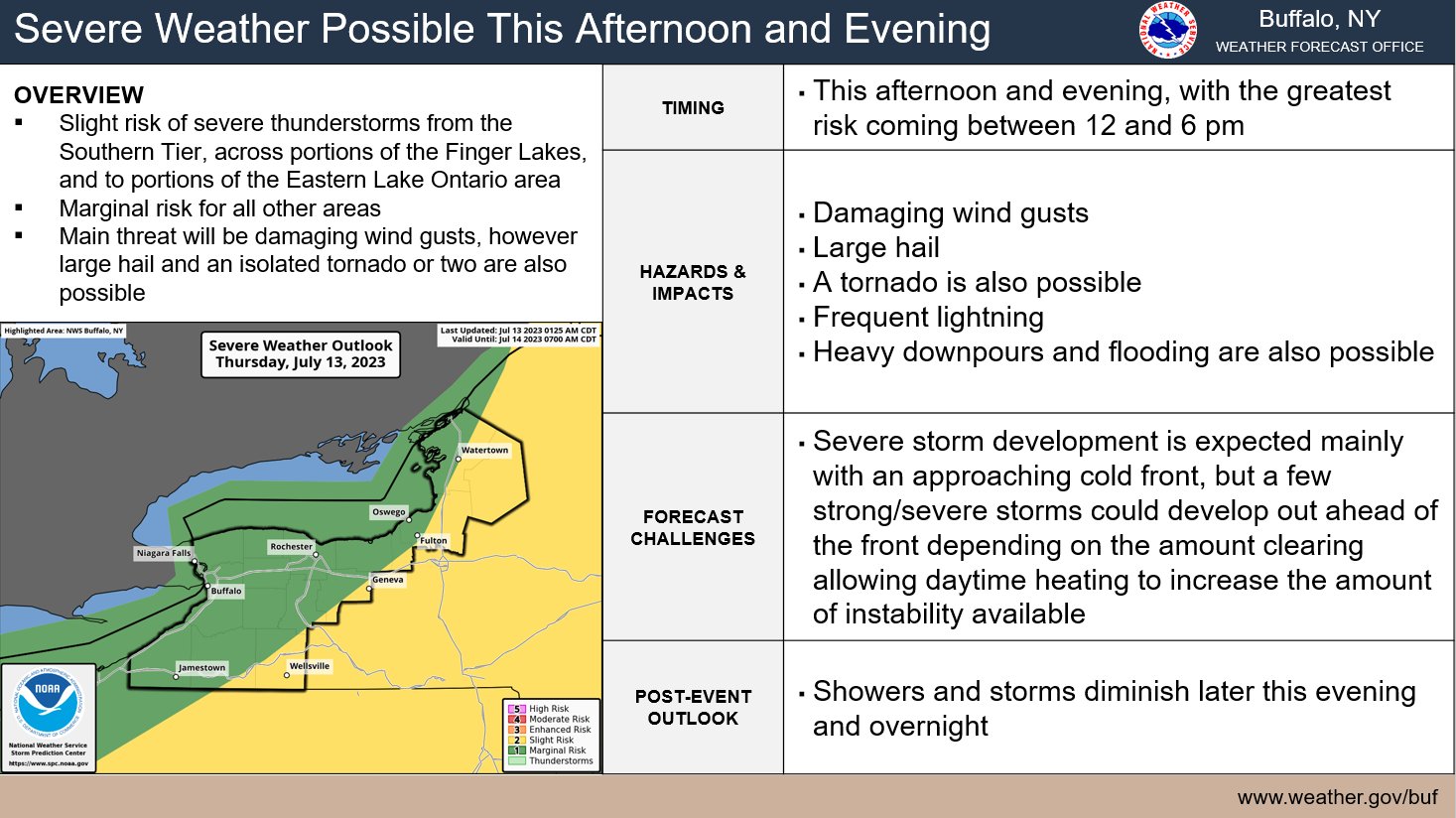
The National Weather Service is watching for thunderstorms that could turn severe this afternoon, and bring flooding rain back to the Finger Lakes.
Severe thunderstorms will develop ahead of an approaching cold front, according to the NWS, who says the strength of these storms will vary based on how much clearing and daytime heating is involved.
If clouds clear and sunny skies prevail through the late-morning and early-afternoon, thunderstorms will have a better chance of developing between 12 p.m. and 10 p.m.
The biggest threat with these storms will be heavy rain, damaging winds, hail, and frequent lightning.
The region itself will be cut in half, with the eastern and central portions of the Finger Lakes seeing the greater threat for severe thunderstorms.
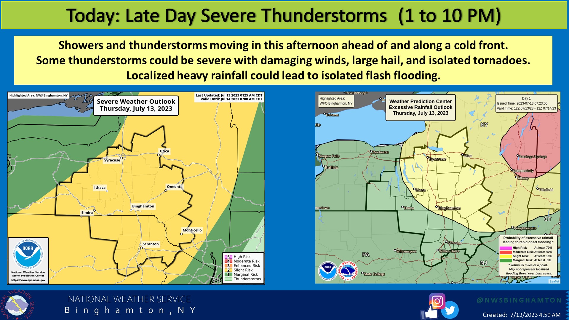
By night, most of this activity will have passed and Friday will be a mostly clear, comfortable day across the entirety of the region.
Radar
Latest Updates
FingerLakes1.com is the region’s leading all-digital news publication. The company was founded in 1998 and has been keeping residents informed for more than two decades. Have a lead? Send it to [email protected]
Read the full article here
Leave a Reply