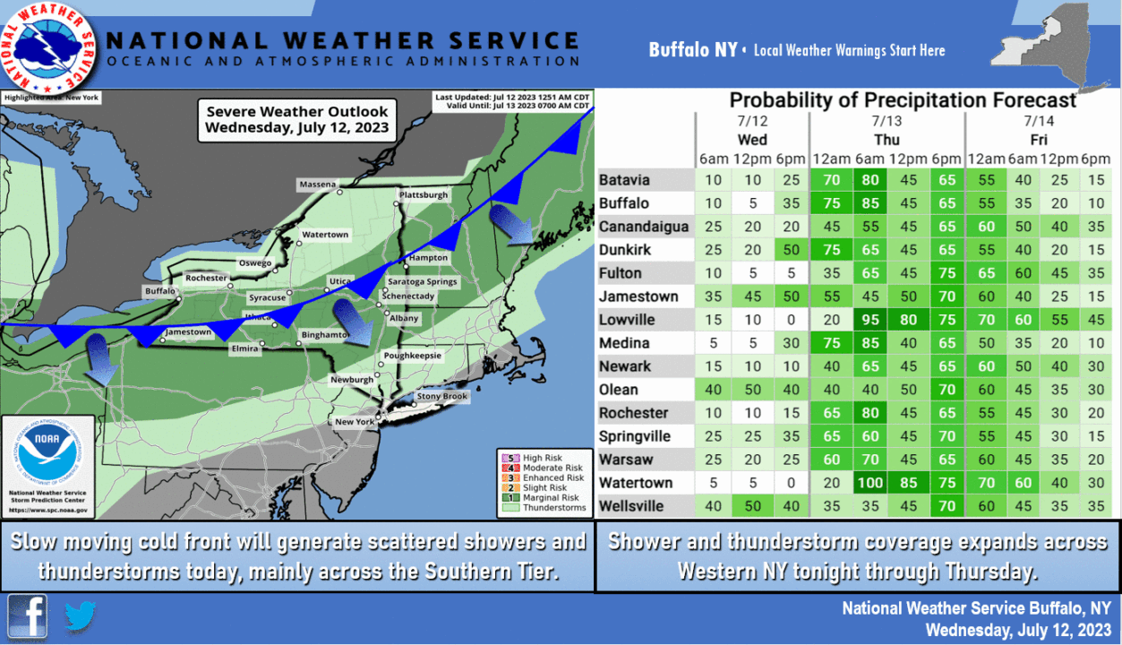
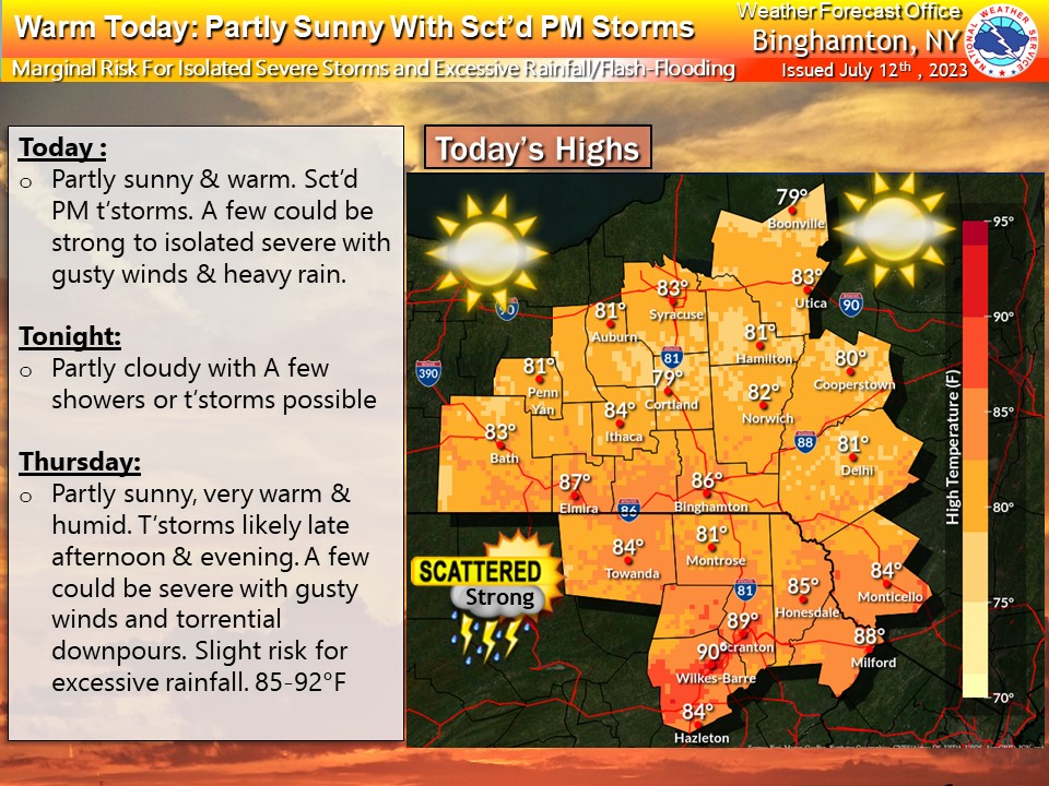
While parts of the Finger Lakes continue to dry out and clean up from torrential thunderstorms that rolled through on Sunday, the stage is set yet again for more unsettled weather over the next 48 hours.
The National Weather Service says a boundary over the region will bring the potential for scattered thunderstorms. The Southern Tier and South/Central Finger Lakes will be in the bullseye, but our entire viewing area will be in play for storms.
The frontal boundary will pivot over the area before moving northward tomorrow. That means waves of rain and thunderstorms will be possible throughout the duration.
While a lot of uncertainty remains about the forecast over the next 48-72 hours – one thing is known: No day will be a washout through the end of the week.
Follow along with the latest radar and alerts from the National Weather Service below.
Radar
Latest Updates
FingerLakes1.com is the region’s leading all-digital news publication. The company was founded in 1998 and has been keeping residents informed for more than two decades. Have a lead? Send it to [email protected]
Read the full article here
Leave a Reply