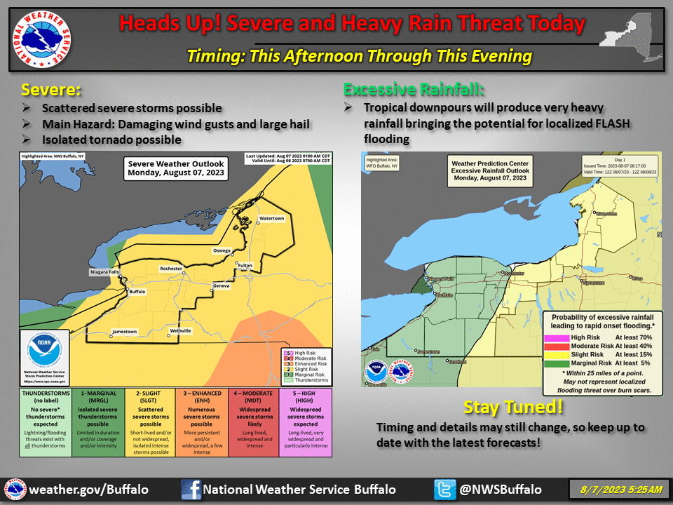
The risk for severe weather will be on the rise today across the Finger Lakes and Central New York.
According to the National Weather Service, the greatest risk will be in the eastern portion of the region. However, storms will brew as late-morning clearing gives way to an atmosphere ripe for thunderstorm development.
Does it mean you should cancel your outdoor plans for Monday? Absolutely not. However, forecasters are watching the afternoon window – between 12 p.m. and 8 p.m. as the time for development.
If a Severe Thunderstorm Watch were to be issued, it would not be unexpected.
In addition to the threat of hail, frequently lightning, and damaging winds with these storms – flash flooding is also a concern.
However, all of this will be highly-localized. Pay attention to local forecasting, and if you hear thunder – head indoors.
Local Radar
FingerLakes1.com is the region’s leading all-digital news publication. The company was founded in 1998 and has been keeping residents informed for more than two decades. Have a lead? Send it to [email protected].
Read the full article here
Leave a Reply