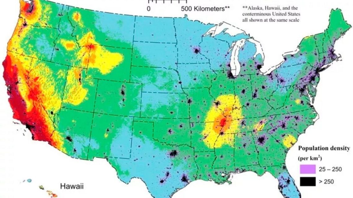
Long Island, along with most of New York State, faces a small but measurable risk of a damaging earthquake, according to new hazard maps released this week by the United States Geological Survey.
The latest USGS National Seismic Hazard Model gives Long Island a 10% chance in a 50-year period of experiencing a Modified Mercalli Intensity scale Level 5 earthquake, and a 2% chance of experiencing a Level 7 earthquake. The intensity scale is based on observable earthquake damage at a particular location, unlike the Richter scale, which measures the motion of the ground to determine an earthquake’s magnitude.
A level 5 intensity could break windows and glassware. A level 7 could damage foundations of one- and two-story wood-frame houses, damage larger buildings and shift furniture.
Nearly three-quarters of the United States could experience damaging earthquakes in a 100-year period, though the risk is highest on the West Coast, where more major fault lines lie. In fact, Wednesday was the 30th anniversary of the 6.7 magnitude Northridge Earthquake at the north end of Los Angeles’s San Fernando Valley.
For perspective, that quake, located in a region noted for its seismic activity, injured more than 9,000 people, killed 60 more, with up to $20 billion in property damage and total economic losses of $40 billion, according to the California Department of Conservation.
A paper on the map models noting Long Island’s chances for a damaging earthquake was published online Dec. 29 in the scientific journal Earthquake Spectra.
“These models that we make forecast where future earthquakes will occur,” said Mark Peterson, a USGS geophysicist and lead author of the paper.
“This is the best available science,” Peterson said. “Engineers will use it in their consideration of building codes and risk assessments.”
Changes to municipal building codes could filter down over the next six years, he said. While New Yorkers should “not forget that earthquakes can affect some of…
Read the full article here


