Don’t worry. There’s no need to grab Toto.
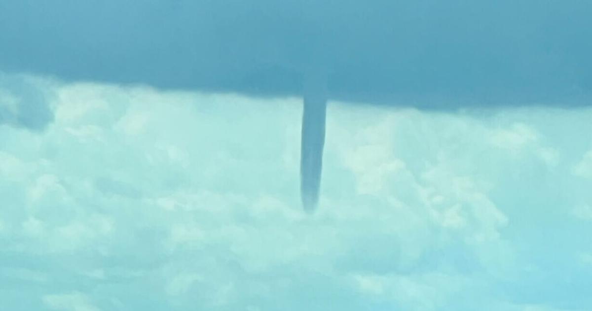
A well-defined funnel cloud appeared midday in Hamburg and South Buffalo, spawning worries about a tornado.
Meteorologists with the National Weather Service office in Buffalo said that their initial investigation indicates it was a “landspout,” which is similar to a “waterspout.”
It was not a tornado, assured meteorologist Phillip Pandolfo.
“A landspout is formed by a very different process than a tornado you may think about when you heard that word,” Pandolfo said.
“It’s a rare situation, but if a waterspout manages to track onto land, that makes it a landspout,” he said.
They can also form as a line of showers moves through the area.
Neither landspouts nor waterspouts pose serious danger. However, winds associated with the formations can sometimes briefly touch down, producing gusts of up to 50 mph.
The weather service said it received multiple reports of a suspected “waterspout” that formed over Lake Erie at about 12:35 p.m.
The weird weather formation was visible from the officers of The Buffalo News in the Larkin District. It appeared by the wind turbines in Lackawanna for a couple of minutes before it disappeared. Other local news outlets also shared photos and videos of the waterspout via social media outlets.
With a line of showers in the area, conditions are favorable for more brief and weak funnel clouds, forecasters said.
The National Weather Service shared some information via X – formerly Twitter – about waterspouts.
They said that waterspouts can occur over large bodies of water and are most common when the water is warm compared to the air, which happens in July through October in Western New York. The waterspouts “tend to form on boundaries” of fronts and lake breezes.
“Most waterspouts are formed by a different process than tornados, but still can pose a hazard to boats,” the weather service said.
They also tend to…
Read the full article here
Leave a Reply